Pittsburgh Drone Services
Advanced Unmanned Aviation Solutions for Property, Infrastructure, and Workforce

Workforce Education
O
Applied Drone Systems & Industry Applications
A comprehensive course that examines how unmanned aircraft systems are deployed across modern industries to solve real operational problems.
Students explore practical use cases in infrastructure inspection, construction, public safety, environmental monitoring, urban planning, utilities, energy, and commercial services.
The course emphasizes mission design, data acquisition, regulatory compliance, risk management, and decision support, bridging technical flight operations with industry-driven outcomes.
Course is available at your worksite or through live online sessions with an instructor.

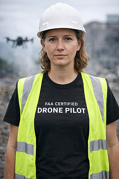
Commercial Drone Certification Program
A professional education program designed to prepare individuals for the FAA Part 107 Remote Pilot Knowledge Test, and for safe, lawful commercial drone operations.
The course covers airspace classification, FAA regulations, weather interpretation, crew resource management, loading and performance, emergency procedures, risk mitigation, and operational decision-making.
Course is available at your worksite or through live online sessions with an instructor.

Aerial Mapping Course
A foundational drone course designed to equip emerging UAS professionals with the core principles of aerial mapping and geospatial data collection.
This course introduces mission planning, sensor selection, flight execution, data acquisition, and basic photogrammetry workflows used to generate accurate maps, models, and measurements.
Course is available at your worksite or live online with an instructor.
